Analizador de Viabilidad de Emplazamientos Geotérmicos
Una solución web diseñada para ayudar a los usuarios a evaluar la viabilidad de un sitio geotérmico según la ubicación.
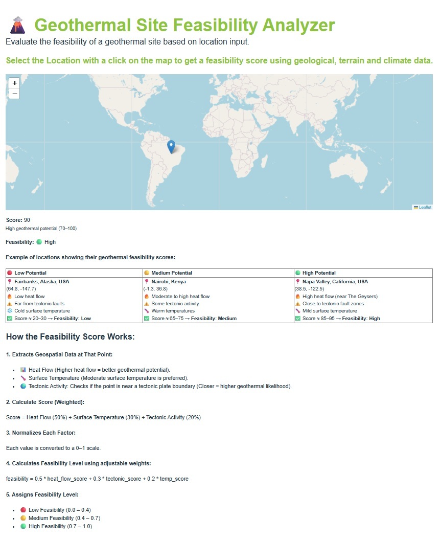
Los usuarios pueden introducir las coordenadas (latitud/longitud) de una ubicación o hacer clic en un mapa, y la aplicación devuelve una puntuación de viabilidad utilizando datos geológicos, de terreno y climáticos.
🔗 Probar Demo (Enlace externo: Puede tardar unos segundos en cargar)
Una herramienta para ingenieros y diseñadores:
✅ Seleccionar una ubicación en un mapa.
✅ Extraer datos geoespaciales del punto seleccionado.
✅ Calcular la puntuación (ponderada).
✅ Calcular el nivel de viabilidad mediante ponderaciones ajustables.
⚙️ Frontend: React, Vite, Bootstrap y Leaflet (map input, visualización).
⚙️ Backend: Flask + Librerías Geoespaciales (p.ej., GDAL, Rasterio, GeoPandas etc.).
⚙️ Fuentes de datos: Datos ráster de flujo de calor global, límites de placas tectónicas (GeoJSON), datos ráster de temperatura superficial, conjuntos de datos de aguas subterráneas.